Crypt Lake
Crypt Lake is widely considered one of the top hikes in Canada. The distance to Crypt Lake is about 9km and the elevation gained is about 2300ft(700m). The starting point for the vast majority of people is the Marina within the Waterton townsite as you need to take a boat to the Crypt landing site as the trail is situated on the other side of the lake. The other way is via the Chief Mountain Highway and turn on the Wishbone trail but this adds about 15km each way to your journey and the boat ride is a lot more fun, more picturesque and saves a lot of time. Of course, going via boat means there is a schedule to adhere to and a fee for the shuttle. It is best to check with the front desk in the hotel you are staying with or the Information Centre situtated at the start to the Bear's Hump hike what the times and the cost are for the year as these can change from year to year. It is advisable to purchase your ticket an hour to 30 minutes before the boat leaves to avoid disappointment. Also, there are pickup times in the evening but you shall be advised of these times at the Marina and on the boat.
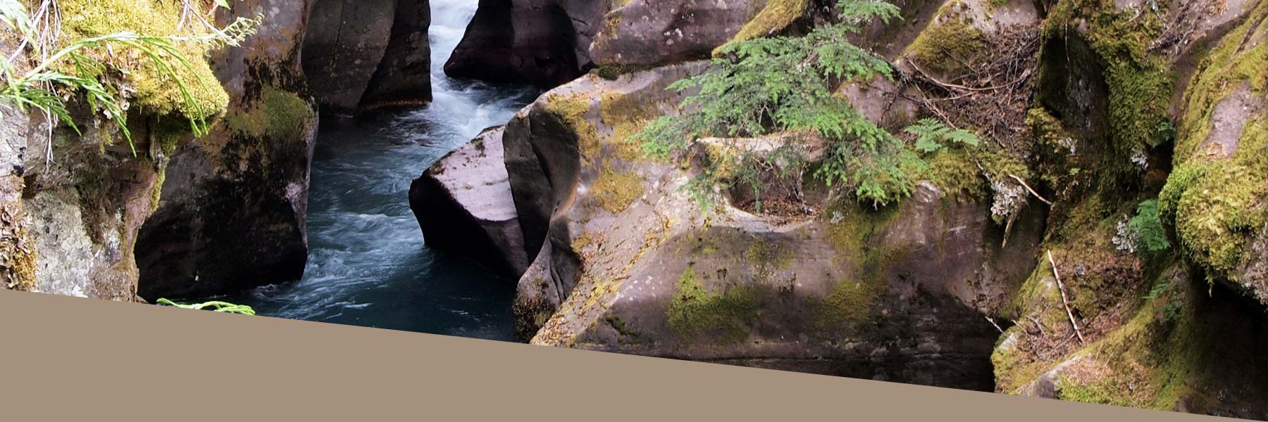
Unfortunately, if you miss the final boat you will have either have to camp on the landing site that evening or make your way back via the Wishbone Trail but this is highly unlikely because you should have plenty of time and more a joke made by the crew of the boat. The departure times for 2009 where 9am in July and August and 10am from May to September and the pickup times are either 4pm or 415pm depending on the time of year and 530pm all season long. But again check with the Marina as these times can change along with the price. The actual hike itself starts of at crypt landing site and a couple of meters after this you encounter a sign, go right for Crypt if you go left you will make your way onto the Wishbone trail and may end up on Vimy peak which overlooks the town. The trail itself is a gradual climb which gets tougher in the second half as the trail leaves the forest and goes in the open with many switchbacks taking the steepest part of the mountain out of the climb out of it. There are many waterfalls you can see along the trail, Hell Roaring Falls, Twin Falls, Burnt Rock Falls and Crypt Falls.
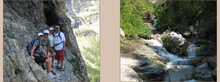
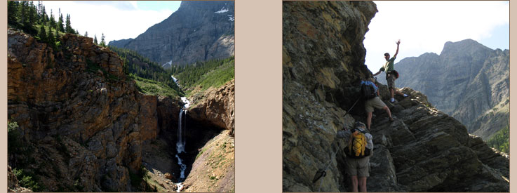
Hell-Roaring Falls is a seperate trail on your route to Crypt but it is advisable to do it on your way back. You should set aside 30 minutes to an hour for it. Crypt Falls can be seen as you make the steady uphill approach to the tunnel and it is quite a spectacular sight as it descends into the valley and lake below. The natural tunnel is about 20m(65ft) long and you need to use the steel ladder to make your way up to it and down from it on the other side. The tunnel is quite easy to travel through. Once out of the tunnel, you make your way along a short cliff ledge with a cable beside you for support but the ledge is not that dangerous and is wide enough for 2 people to cross rather uncomfortably together but there is plenty of space. Once the cliff ledge has been completed you make your way towards the lake. The lake is bordered by Mt Boswell and Vimy Ridge. On the opposite side of Crypt is a year round snow field that is located in the US as the International Boundary intersects the lake so a short stroll to the far side brings you onto the US side of the Peace Park. Altogether the whole trip is about 18km long and with a maximum elevation of roughly 6500ft(1950m) above sea level.