Hiking in Waterton
Waterton Lakes National Park boasts world class hiking trails with unparalled scenery and the opportunity for many wildlife encounters. There are 255 km (191 miles) of managed trails in Waterton Lakes National Park ranging in difficulty from short jaunts to steep advanced treks that can take days. A variety of the trails can be used for different purposes, hikers, equestrian trails, and bicycling. Many of Waterton's trails also lead to large trail systems in Montana's Glacier National Park and in British Columbia's Akamina-Kishenina Provincial Park.
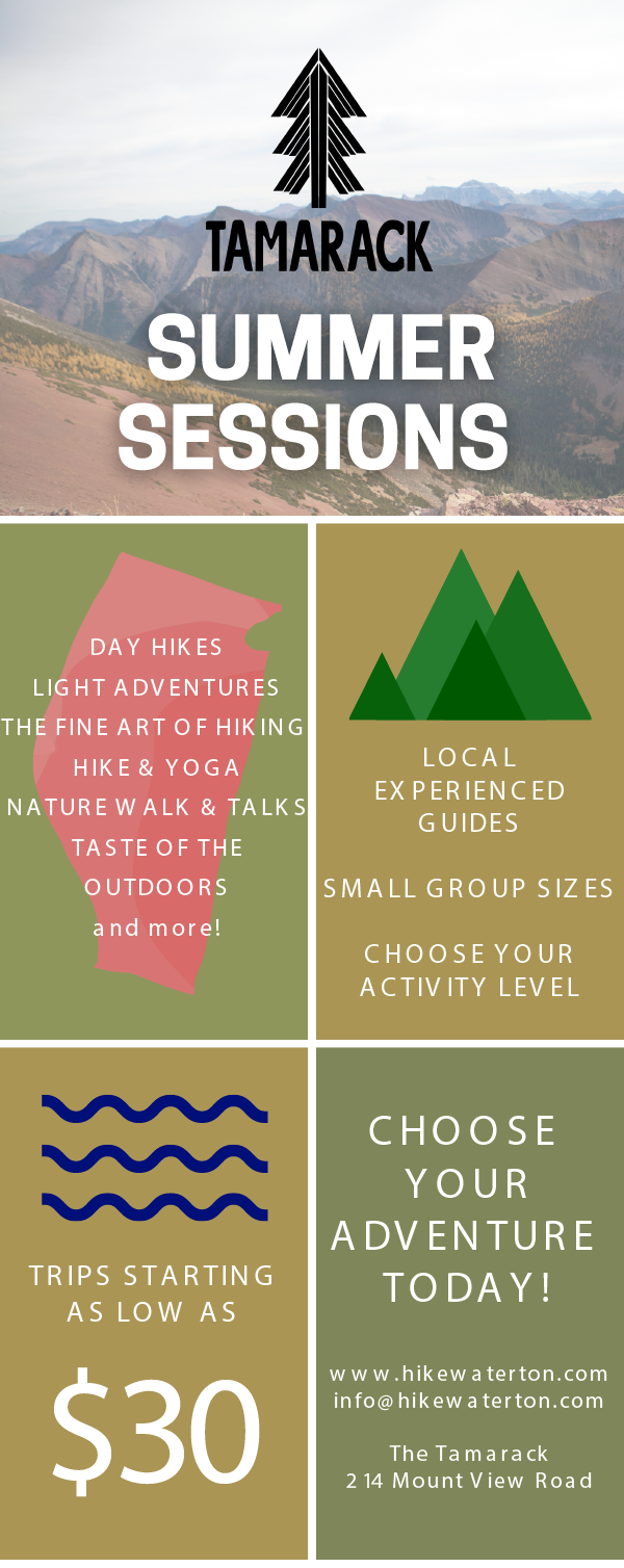
Guided Hiking & Interpretive Hikes in Waterton Lakes National Park

Tamarack Outdoors can help tailor an experience to exactly what you are looking for in a guided hike in Waterton. From Nature Walk & Talks to half and full day adveenutres, visit Tamarack Outdoors for options on Waterton guided hikes today.
To learn more about customized hiking experiences in Waterton please contact Tamarack Outdoors at:
The Tamarack
IGA Certified Hiking Guides
Waterton Lakes National Park
Website:
Email: info@hikewaterton.com
Hiking Trails of Waterton
| Trails | Trailhead | Distance (One Way) | Time (One Way) | Elevation Gained | Difficulty |
|---|---|---|---|---|---|
| Town site | Town Loop | 3.2km (2 mi) | 1 hour | Minimal | Easy |
| Emerald Bay loop | Town site | 2 km (1.2 mi) | 45 min | Minimal | Easy |
| Linnet Lake | Across Gov't. Compound | 1 km (.6 mi) | 30 min | Minimal | Easy |
| Cameron Lakeshore | Cameron Lake | 1.6 km (1 mi.) | 30 min | Minimal | Easy |
| Akamina Lake | Cameron Lake | 0.5 km (0.3 mi.) | 15 min | Minimal | Easy |
| Red Rock Canyon | Red Rock Canyon | 0.7 km (0.4 mi.) | 20 min | Minimal | Easy |
| Blakiston Falls | Red Rock Canyon | 1 km (0.6 mi.) | 30 min | Minimal | Easy |
| Lower Bertha Falls | Town site | 2.8 km (1.8 mi) | 45 min | 150 m. (429') | Moderately Easy |
| Crandell Lake | From Red Rock Parkway | 2 km (1.2 mi) | 1 hour | 100 m. (328') | Moderately Easy |
| Crandell Lake | From Akamina Parkway | 1.2 km (0.7 mi.) | 45 min | 100 m. (328') | Moderately Easy |
| Wall Lake, B.C. | Akamina Parkway | 4.5 km (2.7 mi.) | 2 hours | 165 m. (512') | Moderately Easy |
| Bear's Hump | Visitors Center | 1.4 km (0.9 mi.) | 40 min | 200 m. (656') | Moderately Difficult |
| Goat Lake | Red Rock Canyon | 6.3 km (3.5 mi.) | 2 hours | 400 m. (1312') | Moderately Difficult |
| Crypt Lake | Crypt Landing | 8.6 km (5.4) | 3-4 hours | 700 m. (2296") | Moderately Difficult |
| Carthew-Alderson | From Cameron Lake | 19 km (12 mi.) | 6-8 hour | 600 m. (1968') | Moderately Difficult |
| Wishbone (to Lower Lake) | Chief Mountain Highway | 10.5 km (6.2 mi.) | 2-3 hours | Minimal | Moderately Difficult |
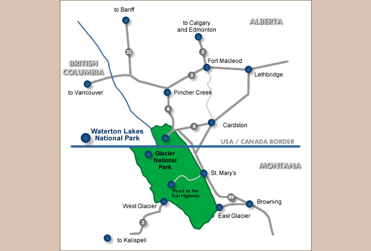
Park Map