The Front Range of Waterton - Sofa Mountain
Distance: 16.0 km / 9.9 mi (round trip)
Time: 7 to 9 hours (plan a full day)
Elevation Gain: 700 m / 2297 ft
Download a .gpx file of our hike here. Just click the link and download and extract the Zip file: sofa_mountain.gpx
|
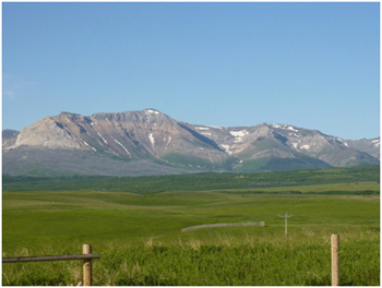
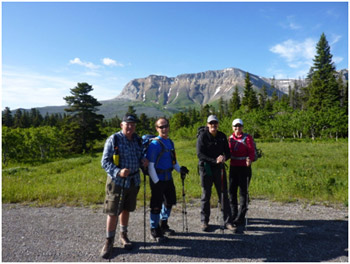
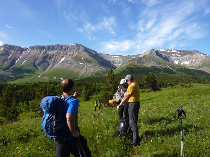
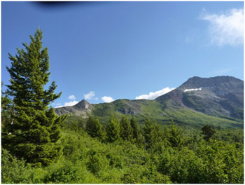
It was a beautiful day again in paradise! I have been lucky hiking this year as I have peaked 4 mountains in fantastic weather every time. On June 16, 2013 we did another Front Range mountain in Waterton Lakes National Park, Sofa Mountain. Instead of coming back one of the two usual ways after peaking the summit we walked the entire ridge west off the west shoulder, through Sofa Creek and then up onto the Vimy Trail. The bushwhacking was surprisingly easy and we had the good luck in not getting lost. We scheduled our Experience Waterton Meetup.com for Pearls Café in Waterton for 8:00 a.m. The picture to the right is Sofa Mountain from my backyard. This is the closest Waterton Mountain to my house. I live on the Belly River which is the river that comes out of the Belly River Lake in Glacier National Park through Waterton Lakes National Park, across the southern prairies of Alberta and empties into the Old Man River. |
|
|
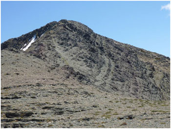
After meeting at Pearls, we drove out of the Park turning right after the gate, and right again onto #6 highway, the Chief Mountain Highway south. We drove a few miles south climbing the hill where you come to the spectacular lookout overlooking Waterton Lakes National Park. The trailhead for Sofa Mountain is the very next turnout after the outlook. It is a small graveled lookout approximately 1 mile down the road after the outlook. From the trailhead you have a stunning view of Sofa Mountain. The big V in the centre view of the mountain is essentially the two shoulders that you can easily ascend to reach the peak. The waterfall coming out of the V is called the Crooked Creek Waterfall. |
|
|
|
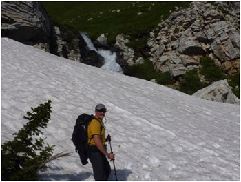
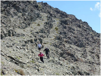
At the parking lot you find the trail that heads straight south to the Crooked Creek Falls. The trail is easy to find and well defined right to the Crooked Creek Falls. It is an old cross country ski trail which at one time was maintained by Parks Canada. The hike to Crooked Creek is surprisingly beautiful even though there is little elevation. It took us just over an hour to travel the approximate 2 miles (3.2 kilometers). We crossed snow to get across the creek to head up the left shoulder. There is no visible trail from that point onward. You merely head straight up the shoulder until you hit the rock band. We tended towards the east shoulder. |
|
|
|
|
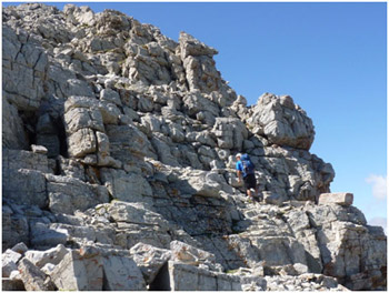
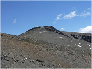
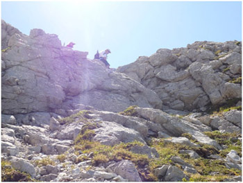
Right near the top you start to run into large boulders. Near the very top the boulders turn into relatively easy bouldering terrain. Once you get to the top of the boulders you hit the first peak and have stunning views of the prairies. |
|
|
|
|
|
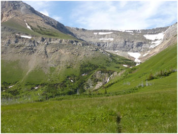
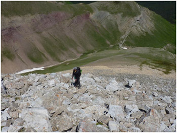
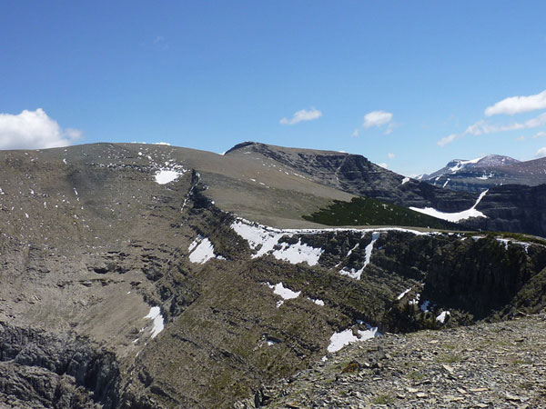
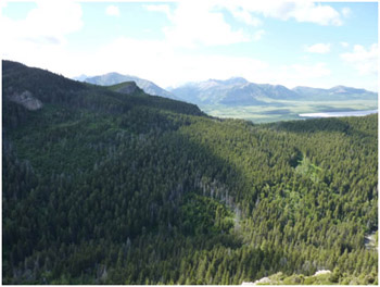
The actual peak is to the south and east of the first peak. Like Crandell Mountain, Sofa Mountain has a large table top and hikers stay skyline for a long period of time. There is nothing technical to get to the peak and you can see down the entire ridge. From the peak to the falls it took us approximately 3 hours which included a long lunch break. Once we ascended the peak we headed back past where we started as we intended to walk the entire ridge. |
|
|
|
|
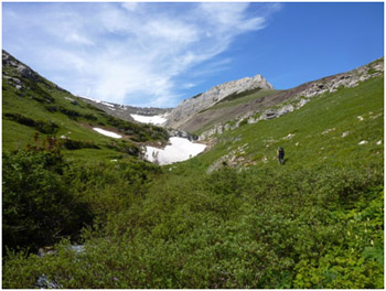
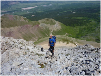
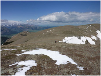
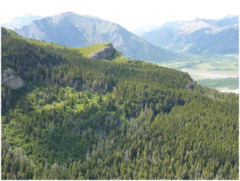
The picture to the right shows the peak you arrive at if you go up the right shoulder from Crooked Creek falls (the west shoulder). The picture below is looking back at the ridge we first ascended and the actual peak is in the distance. |
|
|
|
|
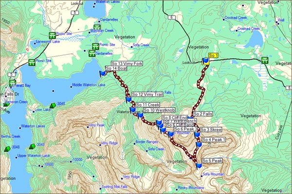
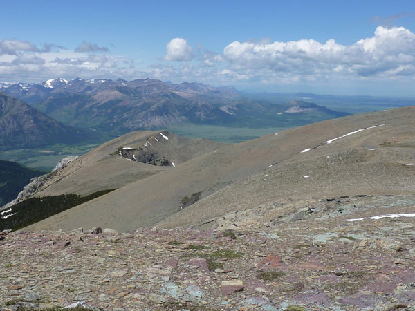
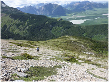
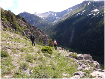
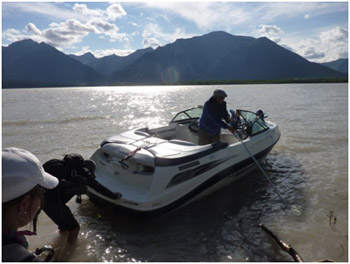
We wanted to walk the entire ridge so made arrangements to get a boat ride at the Vimy junction on the lake. We walked the entire ridge down to Sofa Creek and then climbed to the Vimy Ridge trail. There appeared to be some technical stuff but once we got to what looked hard it was relatively easy. |
|
|
|
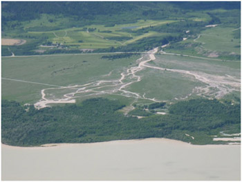
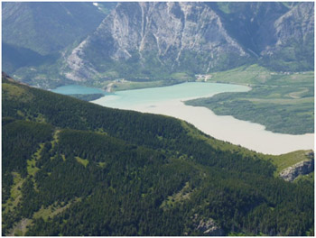
I was able to take some great pictures of the Blakiston Fan. This was a historic week in Alberta as the worst flooding in the history of Alberta had occurred predominately in the Canmore, Calgary and High River areas. There was light flooding in Waterton but no worse than normal. One can see the difference in the water colors from the upper lake to the middle lake. Coming off the ridge was easy. |
|
|
|
|
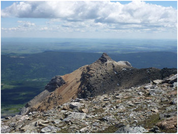
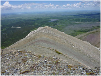
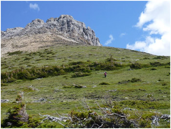
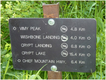
There are a number of ways down the west shoulder, none of which are overly technical. It was a great trip to the west end of the mountain. The only word of caution is that you need to hit the Vimy Trail. Looking over at Vimy you can see the lions head. You want to hit the lowest part of the ridge north of the lions head. See picture immediately below and to the right to understand where you need to go. |
|
|
|
We were able to find scree chute so that we did not have to bushwhack coming down into Sofa Creek. We bushwhacked to the low spot in the ridge and picked up the trail on the ridge. |
|
|
|
|
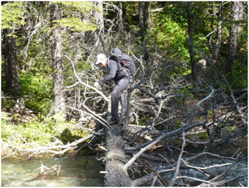
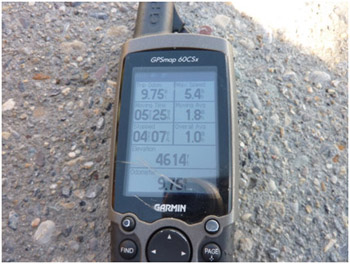
At the Vimy Trail junction one can go north on the Wishbone Trail back to the Chief Mountain Highway or take the wishbone to the Marquee hole turn off and wade the narrows. It would be approximately 1 kilometer to Marquee Hole. In low water it would only be three feet deep. We went a very short distance (maybe 100 yards) and then bushwhacked through the trees once we crossed the little bridge (approximately 6 feet long) and headed to the lake and waited for our pickup. It was a beautiful day. It took us about 9 ½ hours and it was 16 kilometers or approximately 10 miles. Keep on hiking. |
|
|