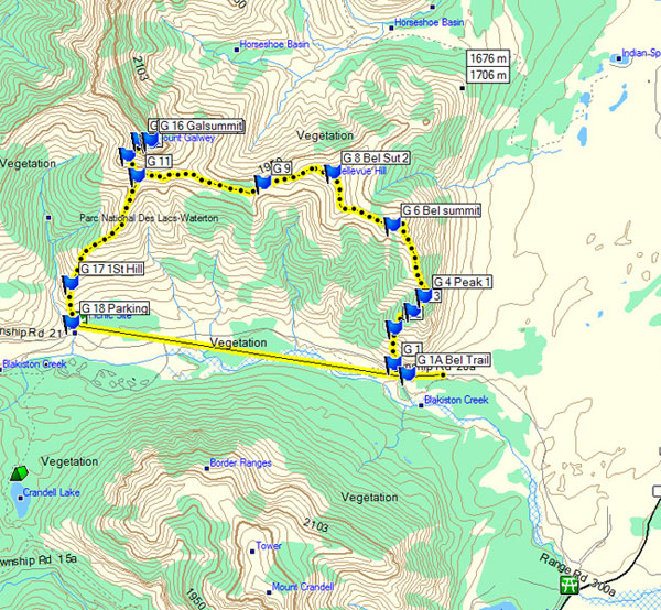
The Front Range of Waterton - Mount Galwey
Distance: 7.2 km / 4.5 mi (round trip)
Time: 4 to 6 hours (plan a full day)
Elevation Gain: 960 m / 3149 ft
Download a .gpx file of our hike here. Just click the link and download and extract the Zip file: mount_galwey.zip
|
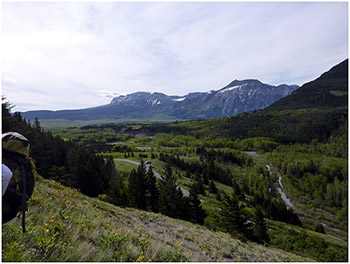
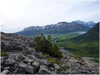
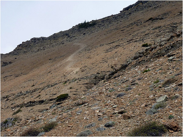
It was a beautiful day on Saturday, June 1, 2013. It was still early in the season so my buddy John and I had touques, gloves and gortex jackets in our back packs. We decided instead of just doing Mount Galwey we would ascend Bellevue Hill and then ridge walk to the Mount Galwey Trail and ascend Mount Galwey. We left John’s car at the Coppermine Creek site on the Red Rock Canyon Road and parked my vehicle at the little parking lot on the corner of Bellevue Hill. From this point, we were still looking over the Golf Course on the other side of Red Rock Creek. I took a great picture 15 minutes into the hike of my truck in the little gravel pad parking lot for climbers doing Bellevue Hill. There is no need to do any bushwhacking or scrambling on Bellevue Hill. We start by walking across the road from the parking lot and scale up the rock gables (rocks in iron mesh baskets) to a clear landing. The best way up Bellevue Hill is what I would call the second ridge. You walk straight up the second ridge and ultimately end up on the ridge overlooking the grassland prairies of Waterton all the way to the little town of Mountain View and north to Fort Macleod. |
Early on the trail. |
|
|
|
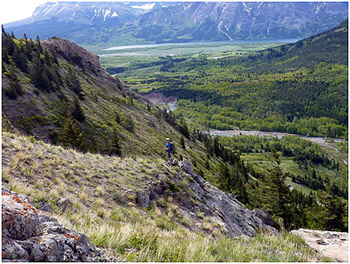
You walk north until you can see that the ridge heads west, head west to summit the actual peak of Bellevue Hill. |
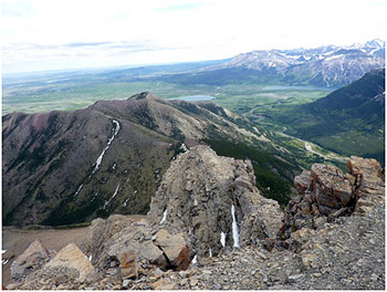
From the peak it is easy to see (bottom right) all the way to Mount Galwey. Just follow the ridge. As you get close to the Galwey Trail there are two little basins to cross which have no difficulty. Once you are on the Galwey Trail it is easy to find the route up the stream. |
|
|
|
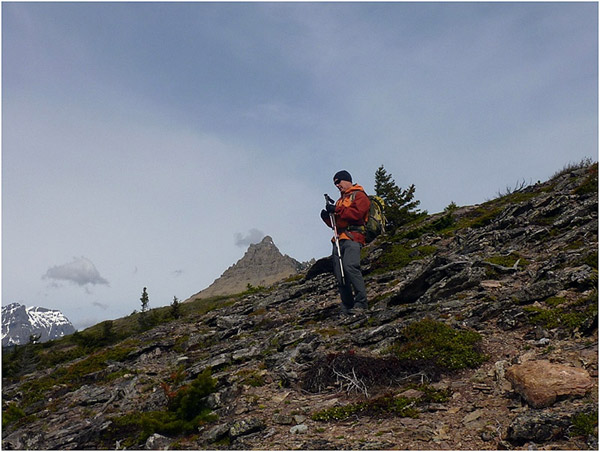
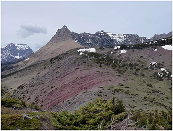
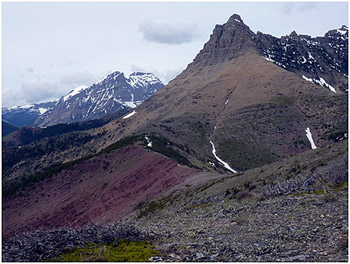
Mount Galwey in the distance. |
|
|
|
|
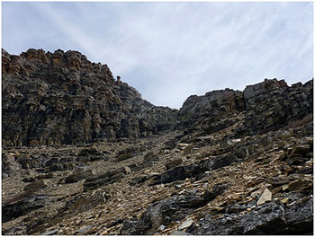
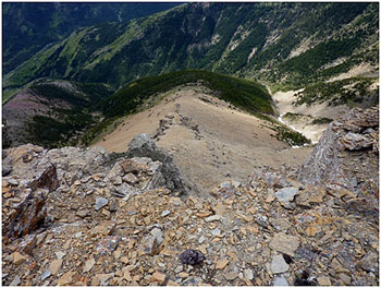
The only complicated part of Mount Galwey is the last 15 minutes. You go west as far as you can and ascend the mountain west to east. When you get behind the mountain on the west side there are two drainage basins that come down. The actual summit is on the second drainage basin. No worries if you go up the first drainage basin. |
You will be overlooking the mountain and you clearly cannot obtain the peak from there. You can follow the west side (the back side) of the ridge to the second drainage basin and then ascend. This is where the trail gets technical and our pictures will be a great description of what you need to do. |
|
|
|
Clear path from here. |
|
|
|
|
You will come to the basin and you will come to a point where you will have to leave your hiking poles and scramble up a shelf about 5 feet high. |
Jon points the way! |
|
|
|
Once you are over the drainage basin you continue east and you will come out on to a little plateau and when you follow a narrow shelf to your left so you are on the east side of the peak. |
|
|
|
|
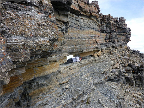
Once you are on the east side of the peak you will see the window and it is a 20 step diversion to crawl through it. |
|
|
|
|
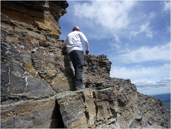
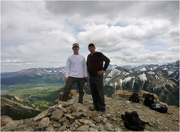
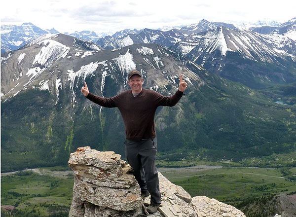
After spending some time at the window John and I summited Mount Galwey. This takes approximately 2 to 3 minutes to do. It is technical and takes a little bit of nerve. |
A number of people do not actually ascend this as a result of the technicalities of the last 30 to 50 feet. |
The hardest part about ascending Galwey is the first lift. Once up it is relatively easy and even on that technical spot people can help each other. |
|
|
|
|
After the technical spot you are 40 steps to the top and just climb up to the chute to peak. |
|
|
|
|
|
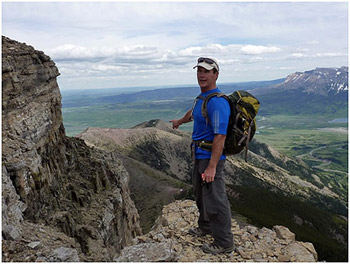
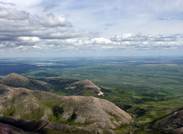
On the top of Mount Galwey you have beautiful stunning views. You can see Crandell Lake (page opposite top) and see all of the grassland prairies from Mountain View to Fort Macleod (bottom right). You have great views of Mount Crandell (which we hiked two weeks later) and all of the Blakiston Valley (below). It was a beautiful sunny day. We met four other hikers on the top of the peak and right before going around the ledge on the window, two other hikers had stopped and determined not to ascend. It was a great day, a great trip. The total trip took us 6 hours 50 minutes from the Bellevue Hill parking lot to return to the Bellevue Hill parking lot. |
Crandell Lake in the distance. |
|
|
|
I would rate our route climbing, to the last 10 minutes of the hike, excellent; the difficulty of the hike, moderate; the technical aspects up to the last 10 minutes, easy; and the last 10 minutes, moderate. |
|